Geolokalisieren

Topografische Karte Xining

Interaktive Karte

Klicken Sie auf die Karte, um die Höhe anzuzeigen.

Über diese Karte

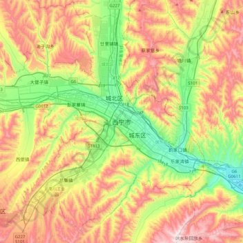
Name: Topografische Karte Xining, Höhe, Relief.

Ort: Xining, Renminjie Subdistrict, Chengzhong District, Xining City, Qinghai, 810000, China (36.45733 101.61620 36.77733 101.93620)

Durchschnittliche Höhe: 2.505 m

Minimale Höhe: 2.140 m

Maximale Höhe: 2.969 m

The city was a commercial hub along the Northern Silk Road's Hexi Corridor for over 2000 years, and was a stronghold of the Han, Sui, Tang, and Song dynasties' resistance against nomadic attacks from the west. Although long a part of Gansu province, Xining was added to Qinghai in 1928. Xining holds sites of religious significance to Muslims and Buddhists, including the Dongguan Mosque and Ta'er Monastery. The city lies in the Huangshui River valley, and owing to its high altitude, has a cool climate on the borderline between cool semi-arid and dry winter humid continental. It is connected by rail to Lhasa, Tibet and connected by high-speed rail to Lanzhou, Gansu and Ürümqi, Xinjiang.

Wikipedia (CC-BY-SA 3.0)