Topografische Karte Shanghai
Interaktive Karte
Klicken Sie auf die Karte, um die Höhe anzuzeigen.
Über diese Karte
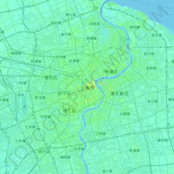
Name: Topografische Karte Shanghai, Höhe, Relief.
Ort: Shanghai, Huangpu District, Shanghai, 200001, China (31.07234 121.30910 31.39234 121.62910)
Durchschnittliche Höhe: 5 m
Minimale Höhe: -6 m
Maximale Höhe: 40 m
The golden age of Shanghai began with its elevation to municipality on 7 July 1927. This new Chinese municipality covered an area of 494.69 km2 (191.0 sq mi), including the modern-day districts of Baoshan, Yangpu, Zhabei, Nanshi, and Pudong, but excluded the foreign concessions territories. Headed by a Chinese mayor and municipal council, the new city government's first task—the Greater Shanghai Plan—was to create a new city center in Jiangwan town of Yangpu district, outside the boundaries of the foreign concessions. The plan included a public museum, library, sports stadium, and city hall, which were partially constructed before being interrupted by the Japanese invasion.
Andere topografische Karten
Klicken Sie auf eine Karte, um ihre Topografie, ihre Höhe und ihr Relief anzuzeigen.
Huangpu District
China > Shanghai > Huangpu District
Huangpu District, Shanghai, 200002, China
Durchschnittliche Höhe: 5 m
Houtan Park
China > Shanghai > Pudong > Sanlin
Houtan Park, Sanlin, Pudong, Shanghai, China
Durchschnittliche Höhe: 6 m
Xuhui District
China > Shanghai > Xuhui District
Xuhui District, Shanghai, 200237, China
Durchschnittliche Höhe: 5 m