
Topografische Karte Yantai
Interaktive Karte
Klicken Sie auf die Karte, um die Höhe anzuzeigen.
Über diese Karte
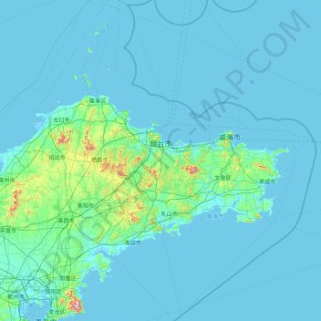
Name: Topografische Karte Yantai, Höhe, Relief.
Ort: Yantai, Shandong, 264000, China (36.06645 119.54889 38.55837 121.92903)
Durchschnittliche Höhe: 30 m
Minimale Höhe: -2 m
Maximale Höhe: 951 m
Andere topografische Karten
Klicken Sie auf eine Karte, um ihre Topografie, ihre Höhe und ihr Relief anzuzeigen.