
Topografische Karte Baotou
Interaktive Karte
Klicken Sie auf die Karte, um die Höhe anzuzeigen.
Über diese Karte
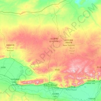
Name: Topografische Karte Baotou, Höhe, Relief.
Ort: Baotou, Innere Mongolei, 014000, China (40.24600 109.26244 42.73599 111.43633)
Durchschnittliche Höhe: 1.316 m
Minimale Höhe: 960 m
Maximale Höhe: 2.294 m
Andere topografische Karten
Klicken Sie auf eine Karte, um ihre Topografie, ihre Höhe und ihr Relief anzuzeigen.