
Topografische Karte Harcourt
Interaktive Karte
Klicken Sie auf die Karte, um die Höhe anzuzeigen.
Über diese Karte
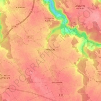
Name: Topografische Karte Harcourt, Höhe, Relief.
Durchschnittliche Höhe: 135 m
Minimale Höhe: 72 m
Maximale Höhe: 155 m
Andere topografische Karten
Klicken Sie auf eine Karte, um ihre Topografie, ihre Höhe und ihr Relief anzuzeigen.
Saint-Germain-des-Angles
France > Normandy > Eure > Saint-Germain-des-Angles
Saint-Germain-des-Angles, Évreux, Eure, Normandy, Metropolitan France, 27930, France
Durchschnittliche Höhe: 100 m
La Trinité
La Trinité, Évreux, Eure, Normandy, Metropolitan France, 27930, France
Durchschnittliche Höhe: 131 m
Mandeville
Mandeville, Bernay, Eure, Normandy, Metropolitan France, 27370, France
Durchschnittliche Höhe: 157 m