
Topografische Karte Uitdam
Interaktive Karte
Klicken Sie auf die Karte, um die Höhe anzuzeigen.
Über diese Karte
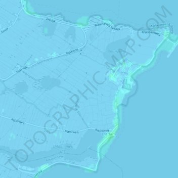
Name: Topografische Karte Uitdam, Höhe, Relief.
Ort: Uitdam, Waterland, Nordholland, Niederlande (52.41513 5.04110 52.43869 5.08877)
Durchschnittliche Höhe: -1 m
Minimale Höhe: -6 m
Maximale Höhe: 4 m
Andere topografische Karten
Klicken Sie auf eine Karte, um ihre Topografie, ihre Höhe und ihr Relief anzuzeigen.
Monnickendam
Niederlande > Nordholland > Waterland
Monnickendam, Waterland, Nordholland, Niederlande
Durchschnittliche Höhe: -2 m
Zuiderwoude
Niederlande > Nordholland > Waterland
Zuiderwoude, Waterland, Nordholland, Niederlande
Durchschnittliche Höhe: -2 m
Watergang
Niederlande > Nordholland > Waterland
Watergang, Waterland, Nordholland, Niederlande
Durchschnittliche Höhe: -2 m
Katwoude
Niederlande > Nordholland > Waterland
Katwoude, Waterland, Nordholland, Niederlande
Durchschnittliche Höhe: -1 m
Waterland
Niederlande > Nordholland > Waterland
Waterland, Nordholland, Niederlande
Durchschnittliche Höhe: -1 m